

Why Pindari Glacier Is A Must-Do Trek?
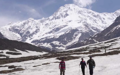
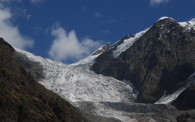
Located in the beautiful Kumaon Himalayas, this glacier attracts both beginners and expert trekkers every year. Pindari Glacier is situated in Nanda Devi Sanctuary and is the source of the Pindar River, which meets Alaknanda at Karanprayag. The route traverses through the southern face of the Nanda Devi Sanctuary amidst its wilderness and along the way, you will catch arresting views of Himalayan peaks like Maiktoli (6,803 m) and Panwali Dwar (6,683 m). To the right of the Pindari Glacier lies the Kafni Glacier. The route to the two glaciers is the same until Dwali, when the road bifurcates, one towards the Pindari Glacier and one towards Kafni Glacier.
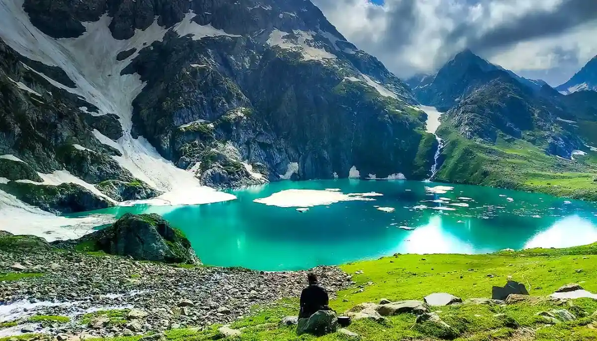
The Kumaon Himalayas are blessed with an abundance of natural beauty and this trek offers varied natural splendors all along the trek. Pindari Glacier lies at the edge of Nanda Devi Peak and the zero point takes you to an astounding altitude of 3,660 meters. This is one of the most easily accessible glaciers in our country and is suitable for anyone who wishes to do the trek. Throughout the trek, you will pass through Rhododendron forests, lush meadows, green valleys, and cascading rivers to the Pindari Glacier summit, where you are welcomed with spellbinding views of Nanda Devi peak. This is one of the most beautiful treks that will leave you speechless after with its incredible scenery.
Pindari Glacier Trek Informative Video
About The Trek
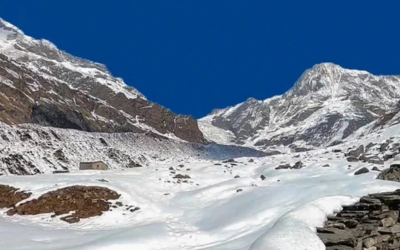
Your trek to this beautiful Himalayan glacier starts at Kharkia, a small village approximately 100 km from Bageshwar, and after crossing a series of remote Himalayan parts like Dwali and Phurkia, you will touch the zero point of the glacier at an altitude of 12,300 ft.
From Kharkiya its a short trek to Khati, where you will get to witness beautiful Rhododendron blooms and views of Himalayan peaks like Nandabaner, Nandakot, and Lapsadhura. BSNL network is available in some parts of the trek. Day 3 is a longer trek to Dwali. Whether here can be unpredictable, so be prepared accordingly. You will pass through a landslide zone and also get glimpses of Kafni Valley on your left.
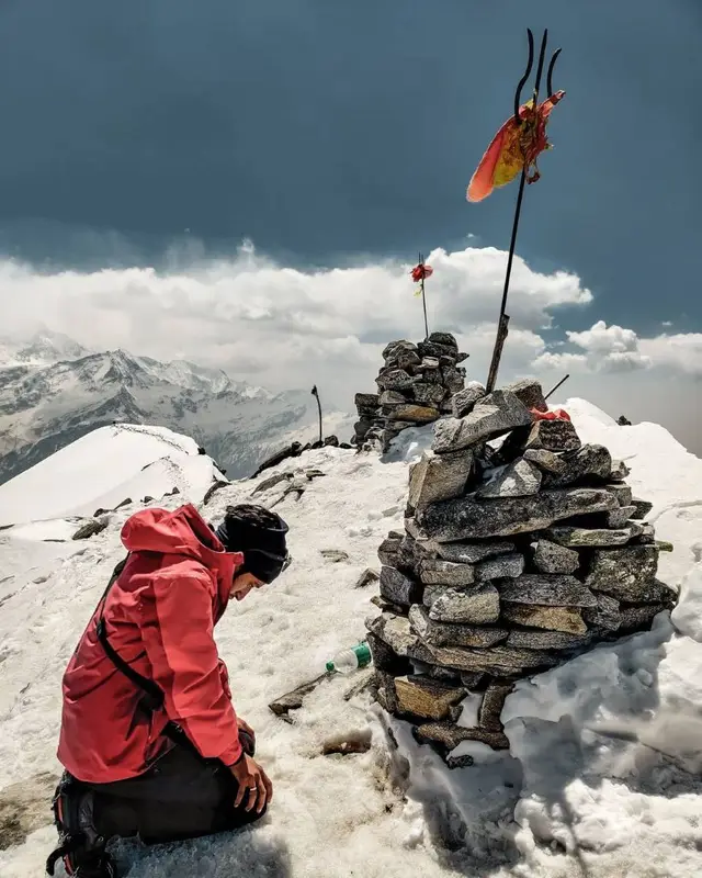
The next day is another short trek to Phurkia and you will get to see the Pindar River flowing below you, the glacier is not too far from here. On clear days, Mt. Nandakhatt & Nanda Devi is vividly visible. You will pass through a meadow where you may spot Himalayan Ibex and also cross a frozen stream. The following day is your summit day as you reach the pinnacle of the trek at 12300 ft. Mt. Nanda Khat is visible from here and you will get to see other mountain peaks like Mt. Bauljuri and Mt. Changuch as well. After spending some time at the glacier you will return to Phurkia.
The next days descent begins as you trek down to Khati via Dwali through the same path that you came in and the next day you will descend from Khati to Kharkia and drive back to Kathgodam ending your incredible Himalayan journey.
What Can You Expect At The Trek
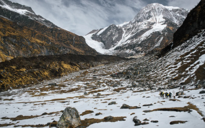
The trek to Pindari Glacier is long but it is easier to complete as compared to other glacier treks in the country. The trek has a medium gradient and from Khati to Phurkia, you will have to cross some caved-in sections and land-slide zones. The glacier itself is 3.2 km in length and 1.5 km in breadth. Mid-April to November is a great time to do the trek, however, it is best to avoid the monsoon season due to landslides and roadblocks.
During April and May, the temperature ranges from 15°C to 20°C during the day and drops between 7°C to 2°C at night. From September to November, the daytime temperature ranges between 15°C to 10°C, and at night it ranges between 5°C to -5°C
The trail has well-defined paths with only one minor pass-crossing. It starts with flat hikes through Rhododendron covers followed by mountain ridges, spider walls, and stream crossings. You also get to learn about local culture and tradition from the local villages that you will pass on your way.
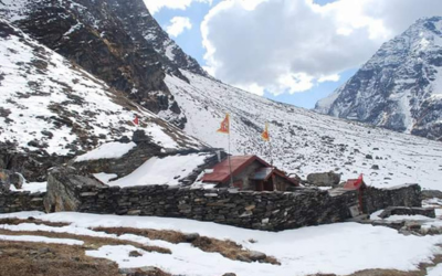
Our mountaineering-certified trek leaders are there to assist you along with the rough patches and all along the way. Our guides are locals who know the mountains like the back of their hands and thus give you a very intimate and comprehensive experience of the Himalayan terrains. Safety is one of our top priorities and our Trek Leaders are also Wilderness First Aid Responders, so you can be assured that you will be safe at all times during the trek.
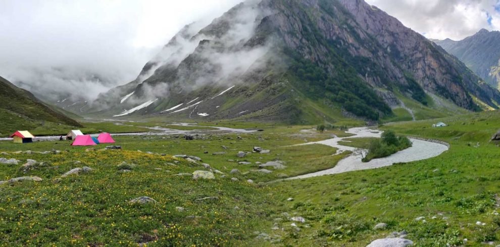
We offer comfortable transfers from Kathgodam to Khati and back, and a cook accompanies us on our trek, who can serve up delicious local cuisine. At night you will stay in comfortable camps. We provide 3-person tents on twin sharing basis to make your stay in the mountains as comfortable as possible.
Since it is a high-altitude trek, the weather may get unpredictable at times, so you should dress appropriately in layers so that you are prepared to tackle all kinds of weather.

Write Your Review