Brijganga Pass Trek
This is an enterprising route that we propose for those who love to spend and explore longer durations on the mountains and explore the area from almost all possible angles.Our trail is above Munsiyari, following Gori Ganga valley and its tributary Ralam Gad, which are connected by Brij Ganga Dhura (pass), the same as Ralam Khal (as shown in the map below). It is different from Ralam Dhura or Ralam Pass (~ 5,500 m), which connects Ralam Valley to Darma Valley towards the east. This area is in the heart of the Kumaon Himalayas and just outside the northern wall of Nanda Devi Sanctuary. Let’s check the map of the area below
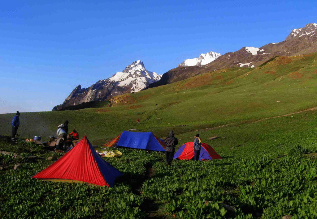
Our route will start from Munsiyari and initially follow the Gori Ganga valley and its tributary named Ralam Gad (river), which is north-east of Munsiary. After exploring the Kalabaland glacier area at the head of the Ralam valley, we finish the first phase of the trek.
During the second phase, we connect Ralam valley to Milam milam valley over Brij Ganga Dhura pass, at 4665 m/15310 ft, which is situated on the ridge above Ralam village. From the pass, we get one of the best views of the Himalayas one may ever get. Towards the north, at the head of Kalabaland glacier, visible peaks are Barphu Dhura, Kalaganga Dhura, Bamba Dhura, Chiring We, and Suitilla. Towards the north-east, at the junction of Sankalp and Yankchar glaciers, you can see Rajrambha, Chaudhara, and Shivu peaks. But the best view is on the west, where the entire northern wall of the Nanda Devi Sanctuary is clearly visible, with the twin peaks (Main and East) dominating the heights on the left. From the pass, we descend to Tola village, which is in the Milam valley. From here, we follow Gori Ganga upstream to Milam village, the last village on the route.
Milam. We get inside the valley between Ganghar and Pachu villages, which are situated on the true right of the Gori Ganga and opposite banks of the side streamr and Pachu villages, which are situated on the true right of the Gori Ganga and opposite banks of the side stream. We camp at the head of the valley to get breathtaking views of Mt. Nanda Devi. Finally, we trace back our path via Martoli to Rilkot and Munsiyari.
Details
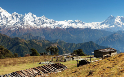
The Brij Ganga Dhura Pass trek is an exhilarating journey through the Kumaon region of Uttarakhand, India. This trek offers adventurers a unique blend of natural beauty, cultural experiences, and challenging terrains. The trail takes you through dense forests, remote villages, and high-altitude passes, providing panoramic views of snow-capped peaks and the surrounding valleys. With altitudes reaching up to 4,666 meters, the trek is both demanding and rewarding, making it ideal for experienced trekkers looking for a thrilling adventure in the Himalayas.
Base Camp – Munsiyari
Month – May, June, Sept, Oct
Nearest Railway – Kathgodam
Airport – Pant Nagar
Stay – Camping, Hotel, Guest House
Food – Veg & Egg
Last Network – Panto
ATM – Munsiyari
- Highest Altitude: 2,150 meters
- Travel Duration: 10-12 hours by road
The journey begins with a drive from Kathgodam to Munsiyari, a quaint town nestled in the heart of the Kumaon region. The drive takes you through picturesque landscapes, including lush green valleys, winding mountain roads, and small hill towns. Munsiyari, located at an altitude of 2,150 meters, serves as the base for the Brij Ganga Dhura Pass trek. Upon arrival, take time to acclimatize and explore the local surroundings.
- Trek Distance: 6 km
- Trek Duration: 4 hours
- Altitude: 2,150 meters
On the second day, a short drive takes you from Munsiyari to Lilam, the starting point of the trek. From Lilam, you begin your trek towards Panto Village. The trail is relatively easy, winding through dense forests of pine and oak. As you trek along the banks of the Gori Ganga River, you will be treated to mesmerizing views of the surrounding mountains. The day ends with an overnight stay in Panto Village.
- Trek Distance: 12 km
- Trek Duration: 8 hours
- Altitude: 2,915 meters
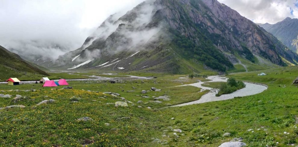
The trek from Panto Village to Lingurani is a bit more challenging, with the trail gradually ascending through thick forests and crossing several streams. The dense vegetation provides shade and a cool environment, making the climb more manageable. As you gain altitude, the landscape begins to change, offering glimpses of snow-capped peaks in the distance. Lingurani is a remote hamlet where you will set up camp for the night.
- Trek Distance: 12 km
- Trek Duration: 8 hours
- Altitude: 3,450 meters
Day 4 involves a steady climb from Lingurani to Kiltam. The trail takes you through alpine meadows, dotted with wildflowers, and offers stunning views of the surrounding valleys. The higher altitude and thinning air may make the trek more strenuous, but the breathtaking vistas make it worth the effort. Kiltam, situated at 3,450 meters, is a small campsite where you can rest and prepare for the next day’s ascent.
- Trek Distance: 11 km
- Trek Duration: 7 hours
- Altitude: 3,970 meters
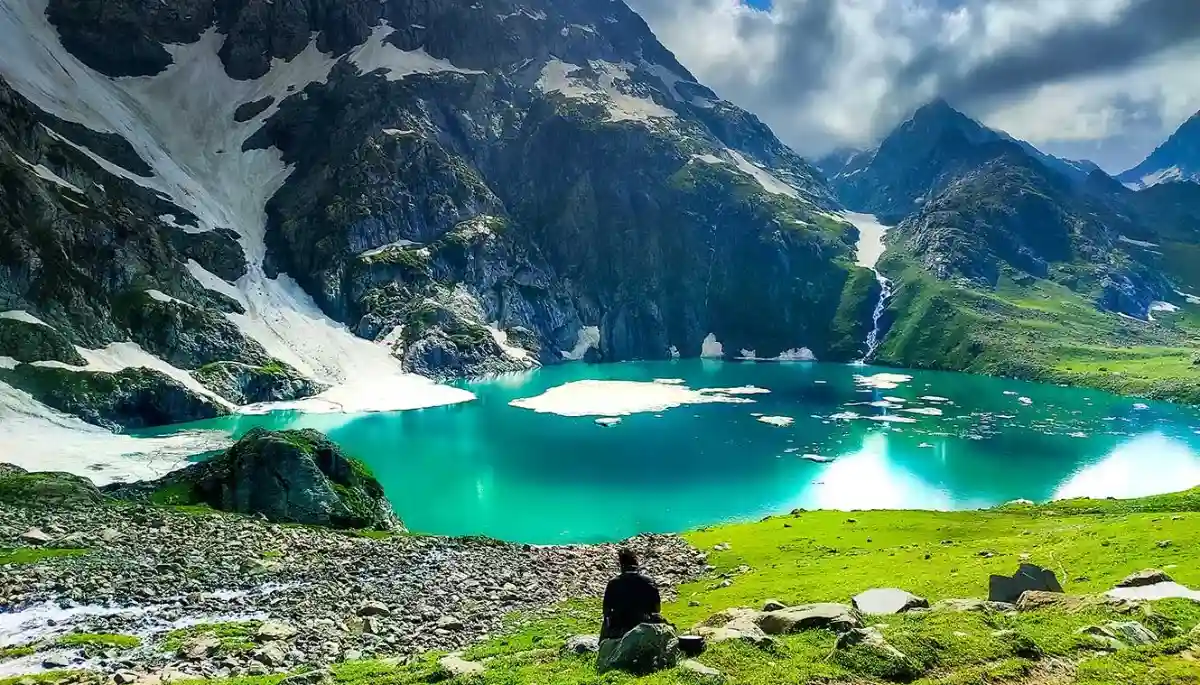
The trek from Kiltam to Upper Marjhali is one of the most scenic parts of the journey. As you ascend, the trail opens up to expansive views of the Himalayan range, including peaks like Sujtela, Rajrambha, Rimlawe, Chiring We. The path is dotted with small streams and patches of snow, adding to the adventure. Upper Marjhali, at nearly 4,000 meters, offers a perfect spot to camp under the stars, with the towering peaks serving as a magnificent backdrop.
- Trek Distance: 9 km
- Trek Duration: 8-9 hours
- Highest Altitude: 4,666 meters (Brij Ganga Pass)
- Altitude at Sumdu: 3,400 meters
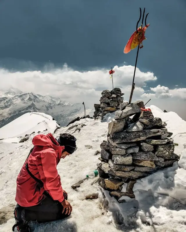
This day is the highlight of the trek as you make your way to the Brij Ganga Dhura Pass, the highest point of the trek at 4,666 meters. The climb is steep and demanding, but the panoramic views from the pass are unparalleled. On a clear day, you can see the entire Kumaon range, with its majestic peaks and deep valleys. After spending some time at the pass, begin the descent towards Sumdu, where you will camp for the night.
- Trek Distance: 9 km
- Trek Duration: 6 hours
- Altitude: 3,230 meters
The descent from Sumdu to Railkot is a relatively easy trek, taking you through alpine forests and along mountain ridges. The trail offers beautiful views of the surrounding valleys and the distant snow-clad peaks. Railkot is a small village where you will spend the night, enjoying the hospitality of the local villagers and experiencing their unique culture.
- Drive: 45 km
- Time: 6-7 hours
As you continue your descent, the trek from Railkot to Bogdiyar takes you through a mix of forested trails and open meadows. The altitude drops significantly, and you will notice a change in the flora and fauna as you enter lower elevations. The day ends at Bogdiyar, a small settlement where you can rest and recover from the day’s trek.
- Travel Duration: 10-12 hours by road
The final day involves a long drive back to Kathgodam. As you descend from the mountains, you’ll carry with you memories of the breathtaking landscapes, the challenging trails, and the sense of accomplishment that comes from completing the Brij Ganga Dhura Pass trek. The journey concludes in Kathgodam, where you can catch a train or continue your travels.


Write Your Review